Gazorpazorp
The one moon in the system with a real atmosphere: half again Earth's pressure at the surface, at 94 K, over a tenth of Earth's pull.
The numbers
These are the figures the map's card shows when you hold your finger on Gazorpazorp, plus the two speeds that decide what a flight there costs. Low orbit speed is how fast you must be going, sideways, to stay up just above the surface. Escape speed is how fast you must be going to leave altogether. Sphere of influence is how far Gazorpazorp's pull reaches before something bigger takes over.
| Figure | Value |
|---|---|
| TYPE | Moon |
| ORBITS | The Box |
| DISTANCE FROM THE BOX | 115.07 Mm |
| ORBIT PERIOD | 6d 13:18:56 |
| ORBIT SHAPE | slightly oval (eccentricity 0.029) |
| RADIUS | 242.5 km |
| GRAVITY | 1.35 m/s² |
| DAY | 6d 13:18:56 |
| STATIONARY ORBIT | none — it turns once per trip round its planet |
| LOW ORBIT SPEED | 436 m/s |
| ESCAPE SPEED | 809 m/s |
| SPHERE OF INFLUENCE | 5.15 Mm |
| ATMOSPHERE | 165.0 km tall |
Stationary orbit is the height where one trip round takes exactly one of the world’s days, so a ship there hangs over the same spot on the ground. See Stationary orbits.
Its day and its orbit are the same length, so Gazorpazorp keeps one face turned toward The Box for ever. Land on the near side and The Box hangs in the sky and never moves; land on the far side and you never see it at all.
What it is made of
What the world is built from. It is not something a ship measures, but it is why the ground looks and behaves as it does — an ice moon takes an impact differently from an iron one.
| Material | Share |
|---|---|
| Water ice | 50 % |
| Silicate rock | 50 % |
The air
Nitrogen with methane in it, at one and a half times Earth's pressure and 94 K — cold enough that the methane is a liquid on the ground. The combination of thick air and weak gravity is what makes a canopy enough here: a lander comes down slowly on drag alone.
| Figure | Value |
|---|---|
| TOP OF THE AIR | 165.0 km |
| PRESSURE AT THE SURFACE | 150 kPa |
| DENSITY AT THE SURFACE | 5.56 kg/m³ |
| HALVES EVERY | 9,704 m |
| TEMPERATURE AT THE SURFACE | 94 K (−179 °C) |
| COOLS BY | 1.1 K per km |
| COLDEST IT GETS | 72 K (−201 °C) |
Pressure falls off as you climb: every 9,704 m of height, there is half as much air around you. A Barometer reads that fall directly, and a Thermometer reads the cooling beside it — 1.1 K for every kilometre, until the air bottoms out at 72 K (−201 °C) and stops getting colder.
What the air is made of
The mix changes with height. Each column is a measured level; between two of them the game blends one into the other, and above the top one there is nothing left to breathe. A Mass Spectrometer reads this table itself: its figure is the mean molar mass of the mix where the reading is taken, and beside it the line names the biggest gases it found. See the Mass Spectrometer.
| Gas | Surface | 60.0 km | 140.0 km |
|---|---|---|---|
| Nitrogen | 94.3 % | 97 % | 97.5 % |
| Methane | 5.7 % | 2.8 % | 2 % |
| Hydrogen | — | 0.2 % | 0.5 % |
Clouds
Cloud decks stand at fixed heights and are drawn wherever you fly. You climb through them on the way up and see them from above afterwards. A cloud is drawn in front of your ship: inside a thick one you lose sight of it until you fly out, so pick your way round the big ones. Each deck mixes several kinds of cloud — sheets, lenses, rows of small cloudlets, wisps, hooks and veils — drawn in this world's own colour.
| Deck | From | To |
|---|---|---|
| Stratus | 8,000 m | 22,000 m |
| Cirrus | 34,000 m | 50,000 m |
The ground
The only world besides Earth with anything you could call shorelines: methane seas below the datum, dune fields beside them, and bright uplands 500 m up.
| Biome | Where | Typical height | Roughness | Damp | Liquid |
|---|---|---|---|---|---|
| Methane Seas | −180° to −108° | −300 m | ± 100 m | 60 % | methane to −200 m |
| Dune Fields | −108° to −36° | 80 m | ± 350 m | 20 % | — |
| Bright Uplands | −36° to 36° | 500 m | ± 1,200 m | 20 % | — |
| Shoreline Flats | 36° to 108° | −50 m | ± 200 m | 40 % | — |
| Polar Lakes | 108° to 180° | −200 m | ± 150 m | 70 % | methane to −200 m |
Where is the band's place round the world, in degrees from the world's own 0°, running out to ±180° on the far side. Typical height is where that biome's ground sits against the datum the map measures altitude from, and roughness is how far it wanders either side of that.
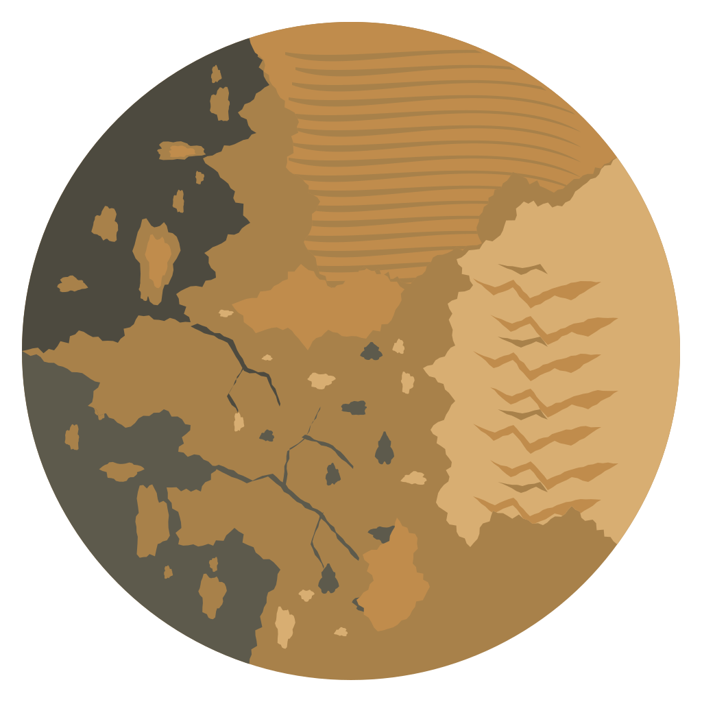
On the map Gazorpazorp is drawn from a painted picture, and you can pick out the coastlines from orbit. The dark ground is liquid methane — the Methane Seas round the far side, eating into the land in bays and inlets, and the Polar Lakes beyond them. Coming the other way from 0°, the pale Bright Uplands stand highest and roughest, the amber ridges of the Dune Fields run below them, and the Shoreline Flats between the dunes and the lakes are cut by branching channels. The colour under you as you come down is the colour of that band.
The methane stands 200 m under the datum in both wet bands, and wherever their ground dips below that it is under liquid. The Kraken Basin holds a sea about 250 km across and over 700 m deep, which runs on round the far side into the Polar Lakes, and Ligeia Hollow holds a lake about 70 km across. Liquid methane weighs 450 kg/m³, under half what Earth's sea does, so a ship sits far lower in it than in water, and one with full tanks sinks to the bottom. See Splashing down.
Named landforms
Gazorpazorp's ground is drawn from a table of named features rather than noise alone, as every world you can stand on is. Where you come to rest is recorded by name, which is why some achievements ask for a summit, a crater floor or a plateau rather than just a landing. All 8 of them are below, in order round the world, from the far side back to 0° and on round.
| Landform | Kind | Where | Height | Flat ground |
|---|---|---|---|---|
| Kraken Basin | Valley | −150° | −600 m | 60,000 m |
| Sea Shelf | Escarpment | −118° | 400 m | 12,000 m |
| Dune Corridor | Plateau | −100° | 120 m | 15,000 m |
| Belet Dunes | Dunes | −70° | 250 m | — |
| Xanadu Uplands | Plateau | −20° | 1,800 m | 30,000 m |
| Doom Mons | Volcano | 15° | 1,500 m | 2,000 m |
| Shoreline Flat | Plateau | 70° | 100 m | 40,000 m |
| Ligeia Hollow | Crater | 140° | 700 m | 20,000 m |
Where is the landform's place round the world, and height is how far it stands above (or below) the ground around it. Flat ground is the level run it promises — the width of the ledge, floor or summit a ship can set down on.
Getting there
Thick air and a light pull together make this the only place beyond Earth where a parachute does the whole job, so the lander that gets you down is the simplest in the outer system. Getting to it is the hard part. Landing pays Gazorpazorp.
Gazorpazorp has no line of its own on the Δv ladder. The nearest figure is The Box's orbit. Getting down from there and back up again costs about its escape speed — 809 m/s — each way on top of that, less whatever its air takes off the descent.
What it pays
Every place nobody has measured before pays discovery the first time an instrument reads it, and how much depends on how far from home the world is. Gazorpazorp counts as 7.00 against Earth's 1.00, so every place on it pays that many times what the same place at home would.
| Figure | Value |
|---|---|
| PLACES TO SURVEY | 18 |
| WORTH IN ALL | 120 discovery |
| CREDITS BESIDE IT | 2,400 |
A place is a world, a band of altitude and — on the ground — the biome you are standing in, and each instrument surveys each place separately. Science and readings explains the whole of it.
What it pays out for
One achievement names Gazorpazorp: Gazorpazorp.
The full list, with what each one pays, is on the Achievements reference.